3
$\begingroup$

Spaceref's NASA's "Tour of Asteroid Bennu" Selected for Prestigious Computer Graphics Film Festival says:

It's hard to imagine what the surface of asteroid Bennu might look like - it's shortest distance from Earth still 250,000 miles away - but the video "Tour of Asteroid Bennu" brings us on a journey to see this landscape up close.

On August 9 and 11, 2021, the video produced at NASA's Goddard Space Flight Center in Greenbelt, Maryland, will be featured in the SIGGRAPH Computer Animation Festival Electronic Theater - a high honor for those in the graphic visualization field.

While the graphics are fantastic and the "tour of Bennu's rocks" is illuminating, the narration is... well... mostly serial mythology factoidisms.

Nonetheless the serial factoids about various rocks on Bennu make it worth a listen.

In the creation stories of ancient Egypt, the universe began as a formless, endless expanse of water. From this primordial sea arose the primordial mound: Benben.

It was upon this rock that the god Atum settled, in the form of the Bennu bird, and sent forth the call that shaped creation.

The story of Benben hearkens to the mounds of fertile silt that once emerged from the receding floodwaters of the Nile, and it provides a fitting namesake for the tallest boulder on Bennu.

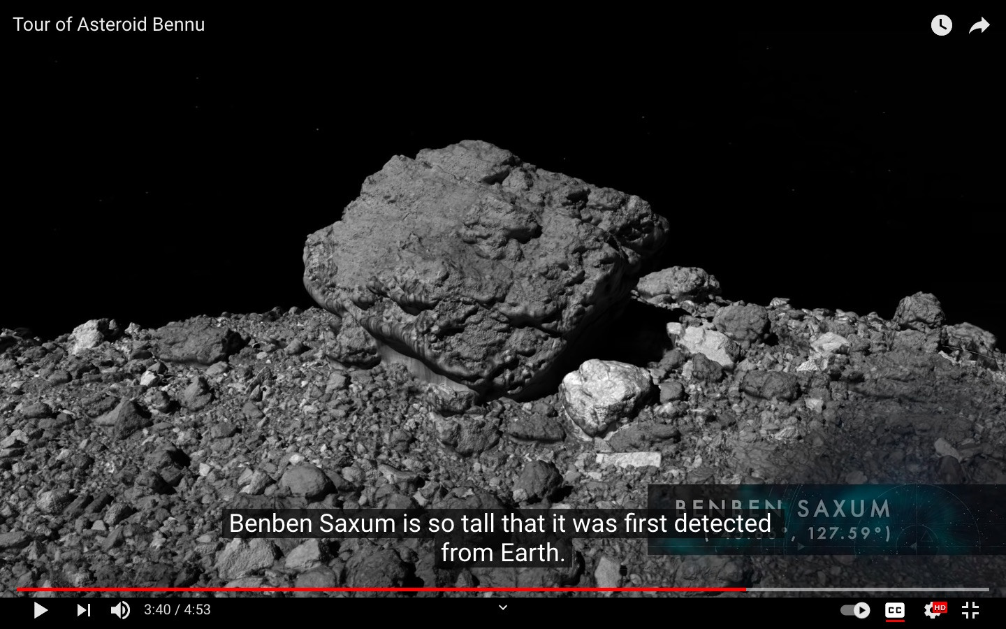
Protruding by over seventy feet, Benben Saxum is so tall that it was first detected from Earth. Now, we can appreciate this monumental feature in detail using data from OSIRIS-REx.

Question: How was a rock Benben Saxum on the surface of asteroid 101955 Bennu first observed from Earth? What instrument and observational technique was used in this rock detection?


Screenshot from the NASA Goddard video "Tour of Asteroid Bennu" https://youtu.be/QunVAWABQSc

$\endgroup$
1

1 Answer 1

4
$\begingroup$

I think it is the "boulder" discovered by Nolan et al. (2013). They used radar images from two ground-based observatories, from two different passes, to perform shape modeling:

The radar observations with Arecibo and the Goldstone planetary radar systems were carried out shortly after discovery, from 21 to 25 September, 1999, and again from 16 September to 2 October in 2005 (Table 1). Further radar observations obtained in September 2011 had too low a signal-to-noise ratio (SNR) to be useful for characterizing the shape of the asteroid.

The modeling process is extensively described in the paper, which is quite technical... The resulting model was used to characterize surface features (among other things):

The shape appears fairly smooth at small scales, with some large-scale features. There is one 10–20 m boulder on the surface that appears in both 1999 and 2005 radar images, but no other small-scale surface features are evident down to the radar resolution of 7.5 m.

20 m is right below the seventy feet mentioned in your question, but given the uncertainty of the model, and the fact that it was the only prominent feature observed, we can be pretty confident it was Benben.

Edit: I finally found a paper mentioning that it is indeed the same boulder! Walsh et al. (2019) wrote (emphasis mine):

Boulders dominate the local topography of Bennu, some with heights >20 m (Fig. 1a). The most prominent boulder on Bennu was first detected with ground-based radar and estimated to be 10 to 20 m in diameter$^2$. This same boulder is apparent in PolyCam images and measures approximately 56 m in its longest dimension (Fig. 1a).

The caption of figure 1a states that said boulder is located at 48°S 125°E, which corresponds to the coordinates of Benben. The boulder is not mentioned by name in the paper, but its name was only approved in 2020.

$\endgroup$
6
  • $\begingroup$ I think I can see something in the GIF here: planetary.org/space-images/estimated-shape-of-asteroid-bennu which also cites Nolan et al 2013. $\endgroup$
    – uhoh
    Commented Aug 22, 2021 at 12:52
  • $\begingroup$ GIF and single frame, annotated. $\endgroup$
    – uhoh
    Commented Aug 22, 2021 at 13:40
  • $\begingroup$ @uhoh Do you have access to the paper? There are images of the boulder in figure 6. Also, they determined that the boulder was in the southern hemisphere, which fits the coordinates of Benben given in the Wikipedia article (45.86°S 127.59°E). $\endgroup$ Commented Aug 22, 2021 at 13:48
  • 1
    $\begingroup$ I've tried looking in later articles citing Nolan et al. if it was indeed the same boulder, but there are almost 200 of them... $\endgroup$ Commented Aug 22, 2021 at 13:50
  • $\begingroup$ Okay I'll be able to download it on Monday. Thanks! $\endgroup$
    – uhoh
    Commented Aug 22, 2021 at 15:11

You must log in to answer this question.

Not the answer you're looking for? Browse other questions tagged .