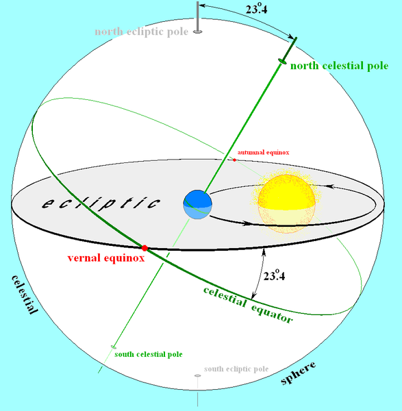
There are a couple of things you have to think about in order to understand the problem at hand. The first is that there are three coordinate systems at play. The first is the celestial coordinate system, which is a coordinate system based upon the latitude and longitude of the Earth (the celestial equator is the Earth's equator projected out into space). See this post.
The second coordinate system is that of the solar system: The plane of the solar system (which contains the sun and planets, and traces out a line in the sky called the ecliptic). Now because of the tilt of the Earth's axis with respect to the normal vector of the plane of the solar system, the celestial equator is not the same as the ecliptic. What's more, is that the relative position of the ecliptic and the celestial equator change throughout the course of the year.
Lastly, there is the altitude/azimuth coordinate system which locked to the observer. The zenith (the point at which all horizons are equidistant from the point you are looking at) is $+90^{\circ}$ in altitude and is a degenerate point in azimuth, and all horizons are $0^{\circ}$ altitude but lay on a unique azimuthal arc stemming from the zenith and intersecting the horizon.
Below is a diagram showing the relationship between the first two coordinate systems, the celestial coordinate system and the coordinate system of the solar system.

Why does all of this matter for the question you've asked? It's because as you look due East and due West, you're looking at $0^{\circ}$ declination (the celestial equator intersects the horizon at exactly due East and due West) whereas the ecliptic intersects the horizon at different points. These points change throughout the year as the relative position of the ecliptic changes with respect to the celestial equator. Now, the amount the sun travels on the ecliptic over a 24 hour period is $0.9856^{\circ}$ ($360^{\circ}/365.25 \text{ days}$; actually I may want to use a sidereal day here but nonetheless it's about a degree).
Due to this, there is potentially a little bit extra in altitude that the sun may travel throughout the course of a day (since the path of the ecliptic is neither aligned with the celestial coordinate system, nor aligned with the local alt/az coordinate system of the observer; unless you're at the north or south poles in which case your local alt/az coordinate system is the same as the celestial coordinate system, however both are still mis-aligned with the coordinate system of the solar system). I think the word "approximate" needs to be there.
All told, I don't personally know how to quantify the extra bit of altitude the sun may gain from the misalignment of the ecliptic with lines of constant altitude and from the sun's motion along the ecliptic, but I would welcome references and calculations from other people. This little bit extra may not be a really small number. In other words, you might want to see how the rate of change of altitude of the sun at that point changes simply due to the Earth's rotation and how it may compare to the rate of change of altitude due to the motion of the sun along the ecliptic.
EDIT:
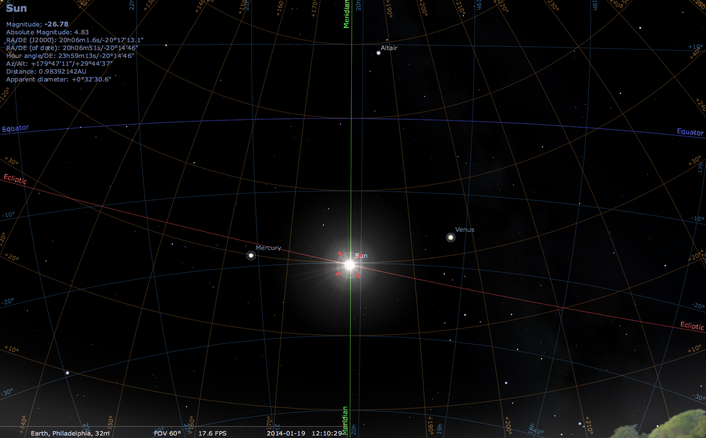
I also just looked to see what the ecliptic looks like on the sky (as seen from Philadelphia), and how it compares to the local alt/az coordinate system. Below is a picture with all coordinate systems present to try to illustrate the point I was trying to make.

The green line is the meridian, the orange(ish) lines are alt/az coordiantes, the blue line is the celestial equator, and the red line is the path of the ecliptic. Hopefully you can make this out sufficiently well.

